Why reflection canyon belongs on your off the beaten path list
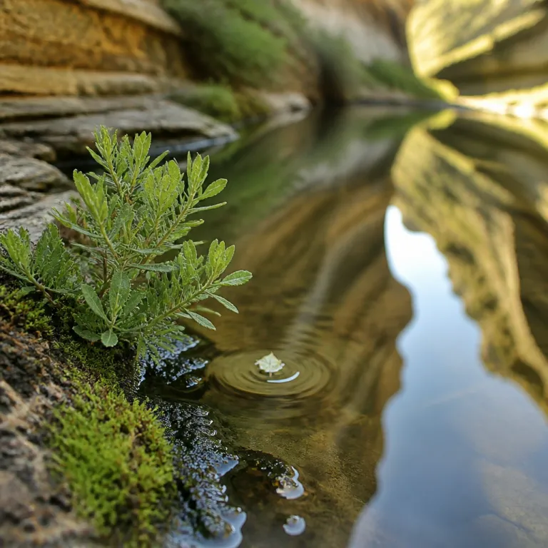
Reflection Canyon sits above the flooded arms of Lake Powell, carved into the sandstone of the wider Glen Canyon region. This remote canyon offers a rare reflection of sculpted rock towers in still water, creating an otherworldly amphitheatre that feels far removed from classic national park viewpoints. For travellers seeking an off the beaten path adventure, the combination of silence, distance and light makes every reflection feel like a private performance.
The hike to Reflection Canyon follows an unmarked desert route across rolling slick rock and sandy benches, rather than a manicured canyon trail with signposts. You will cross a high plateau above the Escalante River country, skirting shallow drainages that eventually feed the greater Glen Canyon National Recreation Area and its intricate network of side canyons. This style of hiking demands strong navigation skills, respect for time and weather, and a willingness to treat every rock ledge and dry wash as part of the route rather than an obstacle.
Unlike many canyon hikes that descend from a busy canyon trailhead into a narrow gorge, this hike to Reflection Canyon begins from a lonely spur off Hole in the Rock Road. The long dirt road drive, the absence of facilities and the lack of reliable water sources keep numbers low, preserving a sense of solitude that is increasingly rare near any national park. For travellers used to marked trails and frequent signage, this canyon hike offers a different kind of national recreation experience, where your decisions and preparation shape the trip more than infrastructure.
Planning the route from escalante and hole in the rock road
Most visitors base themselves in or near Escalante, a small desert town that serves as a gateway to Grand Staircase Escalante country and the wider canyon national landscape. From Escalante, you follow the graded dirt of Hole in the Rock Road, a historic route that cuts deep into the slick rock wilderness toward the edge of Lake Powell. This rock road can be washboarded, rutted or muddy, so your choice of vehicle and your tolerance for rough travel will shape the tone of the adventure long before you reach the informal canyon trailhead.
Hole in the Rock Road traverses the upper layers of the Grand Staircase, linking modern hikers with the same sandstone benches that early settlers once crossed to reach the Colorado River corridor. Today, this corridor forms part of Glen Canyon National Recreation Area, and the final kilometres toward the Reflection Canyon route feel increasingly remote as side tracks peel away toward other canyon trail options. Drivers should check with the local Grand Staircase Escalante office for current road conditions, because a single storm can transform an easy drive into an impassable mud trap in a short time.
The canyon trailhead for the hike to Reflection Canyon is unsigned and unmarked, which reinforces the need for accurate GPS data and a detailed topographic map rather than casual reliance on online pins. Many hikers load a track that shows the approximate route across the open slick rock, but they still adjust for minor variations in terrain, cryptobiotic soil and seasonal water pockets. For travellers who appreciate quiet winter landscapes, the mindset required here is similar to planning a remote Nordic ski traverse, as described in guides to silent tracks and wild horizons far from the crowds.
Understanding the hike: distance, difficulty and timing
The out and back hike to Reflection Canyon is approximately 15.1 miles, with around 560 metres of cumulative elevation gain spread across rolling terrain. While the numbers might suggest a moderate day hike, the lack of a constructed canyon trail, the exposure to sun and the absence of water sources combine to make this a demanding undertaking. Many experienced hikers treat it as a full day hike with generous time margins, even in cooler seasons.
Stronger parties sometimes turn the journey into an overnight backpacking trip, allowing them to reach the rim of the canyon in the late afternoon and photograph the reflection at both sunset and sunrise. This style of backpacking reflection experience requires a permit from the managing authorities, because overnight use in the Glen Canyon National Recreation Area is regulated to protect fragile desert soils and manage human waste. Travellers who are new to desert backpacking should consider hiring a local guide service based in Escalante, which can assist with permits, route planning and realistic time estimates for the hike Reflection Canyon demands.
Those who prefer to keep the outing as a long day hike should start from the canyon trailhead before dawn, using headlamps to cover the first miles while temperatures remain low. Careful pacing on the outward route leaves enough energy for the return across the same slick rock benches, which can feel longer as afternoon heat builds. Families who have enjoyed curated itineraries such as an elegant seven day journey along hidden paths in Costa Rica should recognise that this Utah canyon hike is more committing, with fewer safety nets and a stronger emphasis on self reliance.
Water, safety and navigation in a trackless desert canyon
There is no reliable water along the Reflection Canyon route, so every person must carry their full supply for the entire trip. In practical terms, that means at least four to five litres per person for a cool season day hike, and significantly more in hot weather when the slick rock radiates heat. For an overnight backpacking trip, the weight of water quickly becomes the limiting factor, often dictating whether travellers will commit to camping near the rim or retreat to the vehicle after sunset.
Navigation is another critical safety element, because the hike Reflection Canyon requires does not follow a single obvious canyon trail from start to finish. Instead, hikers weave between low rock domes, sandy drainages and occasional patches of cryptobiotic soil, always aiming to minimise impact while maintaining a coherent route toward the lake. GPS units and offline mapping applications have become standard tools here, reflecting the broader innovation trend in remote hiking, but they should complement rather than replace traditional map and compass skills.
Weather awareness matters as much as navigation, because storms over the wider Glen Canyon basin can transform the character of the terrain even if the sky above the canyon remains clear. Heavy rain can turn sections of Hole in the Rock Road into deep mud, stranding vehicles far from the nearest services and complicating any attempt to visit Reflection Canyon safely. Sensible parties build extra time into their itinerary, carry emergency layers and communication devices, and treat this national recreation area as a true wilderness rather than an extension of a roadside viewpoint.
Photography, geology and the art of timing your visit
Reflection Canyon owes its visual impact to the interplay between sculpted sandstone, still water and the low angle of desert light. When conditions align, the flooded arms of Lake Powell form a perfect mirror that doubles the height of the rock spires, creating the iconic reflection that has appeared in publications and on digital wallpapers. Photographers often plan their hike so they arrive at the rim in the late afternoon, when warm light grazes the canyon walls and the water surface is more likely to be calm.
The geology of this canyon national landscape tells a longer story, one that predates the creation of Glen Canyon Dam and the filling of Lake Powell. Layers of Navajo sandstone, eroded into domes and fins, form the slick rock benches that hikers cross on the way to the overlook, while deeper canyons carry seasonal flows toward the main reservoir. Standing at the rim, you can trace the steps of your own hike across the plateau and imagine the pre reservoir river carving its way through the same rock, long before any national recreation area boundaries existed.
National Geographic photographer Michael Melford helped bring Reflection Canyon to global attention when his images were published, and the location later gained further visibility as a MacBook Pro wallpaper. That surge in interest increased the number of people who wanted to hike Reflection Canyon, but the demanding approach and lack of infrastructure have kept overall visitation relatively modest compared with more accessible national park viewpoints. Serious photographers still treat the trip as a committed backpacking reflection project, willing to carry heavy camera gear and water for many miles in exchange for a few minutes of perfect light over the canyon.
Responsible travel in grand staircase escalante and glen canyon
Reflection Canyon lies near the administrative boundary between Grand Staircase Escalante National Monument and Glen Canyon National Recreation Area, two units that together protect a vast network of canyons, mesas and slick rock domes. Travellers who make the effort to visit Reflection Canyon become ambassadors for this wider landscape, because their behaviour on the trail directly influences how resilient the fragile desert soils remain. Staying on durable rock surfaces, avoiding cryptobiotic crusts and packing out all waste are non negotiable practices in this environment.
For many hikers, the journey to Reflection Canyon is part of a longer road trip that links several canyon hike objectives across the Colorado Plateau. They might combine a day hike on a signed canyon trail in a nearby national park with a more exploratory route along Hole in the Rock Road, or add a backpacking trip in a different section of Glen Canyon to deepen their understanding of the region. Resources that focus on wildlife trekking adventures in off the beaten path destinations can help travellers frame Reflection Canyon as one chapter in a broader portfolio of low impact journeys.
Local guides, the National Park Service and land managers in Grand Staircase Escalante work together to balance access with conservation, especially as social media continues to highlight dramatic canyon views. Travellers who respect permit systems, seasonal closures and route recommendations help ensure that future hikers will still find quiet slick rock benches, clean water in side canyons and intact vegetation along the route. In a world where many iconic viewpoints feel crowded, the choice to treat Reflection Canyon as a privilege rather than a commodity is what will keep this remote rim experience aligned with the values of true adventure travel.
Key figures for the reflection canyon hike
- The out and back distance to the Reflection Canyon rim is approximately 15.1 miles, according to onX Maps, which places it at the upper end of what many hikers consider reasonable for a single day hike.
- The total elevation gain on the Reflection Canyon route is about 1 835 feet, a moderate figure that becomes more demanding because the ascent and descent are spread across rolling slick rock rather than a single canyon trail.
- There are no reliable natural water sources along the Reflection Canyon hike, so parties must carry one hundred percent of their water needs, a factor that significantly increases pack weight for any backpacking trip.
- Permits are required for overnight backpacking reflection itineraries in the Glen Canyon National Recreation Area, which allows managers to monitor use levels and protect sensitive soils near the canyon rim.
- Since National Geographic images of Reflection Canyon were published, interest in the hike has grown, but the long drive on Hole in the Rock Road and the unmarked route have kept visitor numbers far below those of nearby national park viewpoints.
FAQ about hiking to reflection canyon
How long is the hike to Reflection Canyon ?
The hike to Reflection Canyon is approximately 15.1 miles round trip, based on GPS data compiled by mapping platforms such as onX Maps. This distance assumes an out and back route from the informal canyon trailhead off Hole in the Rock Road. Most hikers treat it as a full day outing, allowing extra time for navigation and photography at the rim.
Is there water available on the Reflection Canyon trail ?
There is no reliable water available on the Reflection Canyon route, so every hiker must carry their full supply from the vehicle. Seasonal pools may appear after storms in shallow rock basins, but they are not dependable and should not be part of any safety plan. For both day hikes and overnight backpacking trips, careful water planning is essential.
Do I need a permit to hike or backpack to Reflection Canyon ?
Day hikers currently do not need a specific permit to walk the Reflection Canyon route, although regulations can change and should always be checked with local authorities before travel. Overnight backpacking reflection itineraries in the Glen Canyon National Recreation Area do require a backcountry permit, which helps managers track use and protect fragile desert environments. Travellers should obtain permits in advance and carry them on the trip.
What is the best season and time of day to visit Reflection Canyon ?
Spring and autumn generally offer the most comfortable temperatures for the Reflection Canyon hike, with cooler air and more stable weather than the peak of summer. Many photographers aim to reach the rim in late afternoon or early morning, when low angle light enhances the reflection of rock spires in the still water of Lake Powell. Midday visits are possible but tend to be hotter and less visually dramatic.
How difficult is navigation on the Reflection Canyon route ?
Navigation on the Reflection Canyon hike is moderately challenging, because there is no constructed canyon trail and only intermittent cairns across the slick rock. Most hikers rely on a combination of GPS tracks, topographic maps and visible landmarks to maintain a safe route between the canyon trailhead and the rim. Parties without strong navigation skills should consider travelling with experienced companions or hiring a local guide based in Escalante.
References and further reading
- National Park Service – Glen Canyon National Recreation Area visitor information.
- Bureau of Land Management – Grand Staircase Escalante National Monument travel planning resources.
- onX Maps – digital mapping data for the Reflection Canyon route and surrounding roads.
