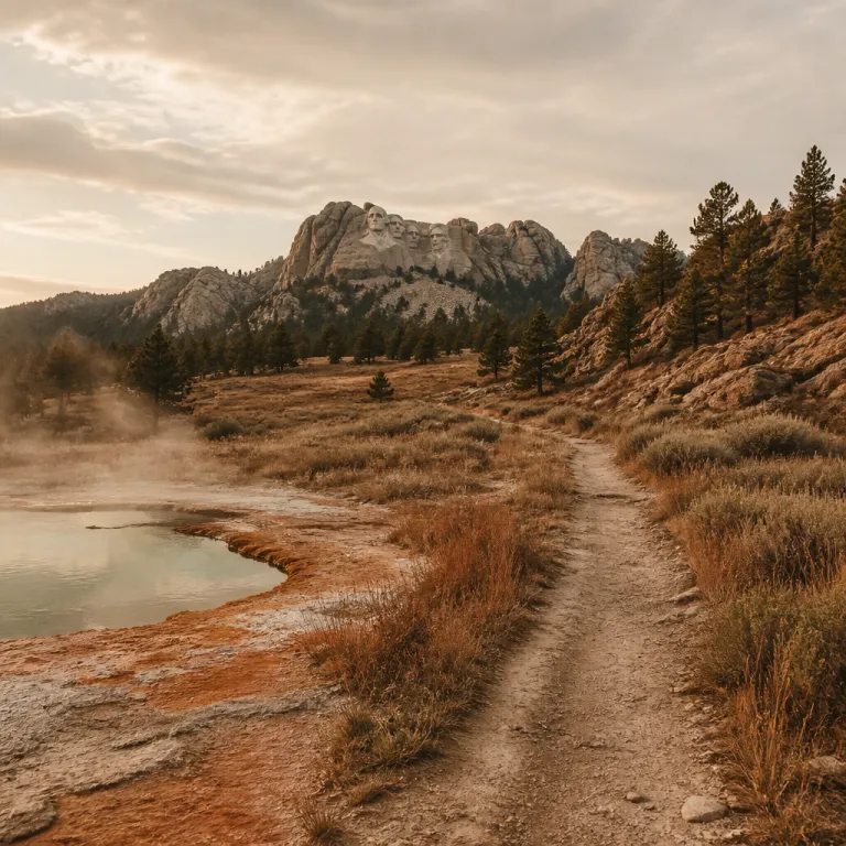
Why the route from Yellowstone park to Mount Rushmore rewards the curious traveler
The journey from Yellowstone park to Mount Rushmore is often treated as a straight transfer between two famous icons. Yet travelers who slow their road trip and leave the main highway will find a chain of quiet canyons, small ranch towns, and lesser known historic sites. This route between Yellowstone National Park and Mount Rushmore National Memorial becomes far richer when you treat it as a cultural corridor rather than a simple drive.
Most visitors rush from one national park to the next in a single day, but the 528 mile distance and 8.5 hour driving time invite a more thoughtful pace. According to Travelmath, the road distance between Yellowstone and Mount Rushmore is roughly 528 miles (about 850 kilometres), which aligns with typical mapping estimates. When you stretch the journey over two or three days, you can weave in state park detours, a national monument or two, and time in Rapid City or Cody that reveals the human stories behind the landscape. A typical pattern is Yellowstone to Cody (about 120–150 miles, 2.5–3.5 hours depending on your exit), Cody to the Bighorn foothills near Ten Sleep (roughly 180 miles, 3.5–4 hours), then Ten Sleep to Devils Tower and on to Rapid City (about 260 miles, 5–6 hours with stops), which turns the classic Yellowstone road into one of the best lesser traveled drives in the American West.
Think of the route as a series of linked regions rather than a single line on a map. You begin in the geothermal basins and wildlife rich valleys of Yellowstone National Park, then cross the high country near Cloud Peak in the Bighorn range, before dropping into the Black Hills and the carved granite of Mount Rushmore. Each region has its own historic landmarks, from buffalo jump sites and frontier forts to the presidential faces at Mount Rushmore and the lesser known caves beneath the Black Hills.
Yellowstone’s quieter corners and the pull of the open road
Yellowstone is usually associated with Old Faithful and crowded viewpoints, yet the park still shelters pockets of solitude. The south entrance corridor toward Grand Teton National Park, the less visited Blacktail Plateau Drive, and the shores of Yellowstone Lake offer space to breathe. When you plan a road trip from Yellowstone park to Mount Rushmore, these quieter areas are where your journey into less frequented territory truly begins.
Base yourself near West Yellowstone or in the park’s northern sector if you want early access to wildlife rich valleys and less congested thermal areas. From these bases you can shape a day that balances classic Yellowstone national sights with lesser known trails such as the Storm Point hike on Yellowstone Lake or the Lost Lake loop near Roosevelt, then exit the park in late afternoon to position yourself for the next day’s drive east. This approach respects both the fragile ecosystems of the national park and your own need for unhurried time in nature.
Before leaving, take one last slow drive along a secondary Yellowstone road rather than the main loop. You might follow the lakeshore near Fishing Bridge, or linger in Hayden Canyon as steam rises from the river and bison graze on the black volcanic soils. On a cool September morning, you may find only a handful of other cars pulled into the overlooks, their drivers sipping coffee in camp mugs while elk bugle in the distance. These final hours in Yellowstone set the tone for the rest of the trip, reminding you that the best journeys are measured not only in kilometres but in the depth of your attention.
For travelers who appreciate volcanic landscapes and thermal waters, the same slow-travel mindset can later be applied to other regions, but along this corridor it is Yellowstone’s high plateaus and river valleys that anchor the experience.
From Cody to the Bighorn high country: where landscape and legend meet
Leaving the west side of Yellowstone, many travelers head straight for the interstate, but the road east toward Cody and the Bighorn Mountains offers a more characterful route. The drive through the Shoshone Canyon, with its black cliffs and the Buffalo Bill Dam, feels like a natural prelude to the grander rock faces you will later see at Mount Rushmore. In Cody itself, the legacy of Buffalo Bill Cody and the town’s museums provide context for the frontier era that shaped both Yellowstone and the wider region.
From Cody, the best lesser known option is to angle northeast toward Ten Sleep and the Cloud Peak area of the Bighorn range rather than racing directly to Rapid City. This route threads through a landscape of red rock canyons, high meadows, and working ranches, where the road trip becomes a moving lesson in how people have adapted to this demanding environment. On summer evenings in Cody, you might see kids in dusty boots lining up for ice cream on Sheridan Avenue while rodeo contestants haul horse trailers toward the arena, a reminder that this is a lived-in place, not just a scenic backdrop. Ten Sleep, with its climbing cliffs and quiet main street, offers a human scale pause between the grand drama of Yellowstone and the carved symbolism of Mount Rushmore.
As you climb toward Cloud Peak, the road cuts through layers of exposed geology that predate the national park system itself. Pullouts along U.S. 16 over Powder River Pass (around milepost 57–60 east of Ten Sleep) reveal deep time in the rock, even though nearby Beartooth Highway to the north is more widely known among international visitors. Choosing this more southerly Bighorn route keeps you away from the busiest corridors while still aligning your journey from Yellowstone park to Mount Rushmore with some of the most evocative mountain scenery in the American West.
Travelers who enjoy this blend of landscape and culture often seek out similar cross-border itineraries elsewhere, where mountain passes, small cities, and historic landmarks are woven into a single narrative, but along this stretch of Wyoming the focus remains firmly on the Bighorn foothills and the communities that line the road.
Devils Tower, the Black Hills, and the layered story of sacred stone
As you leave the Bighorn region and angle toward South Dakota, the isolated form of Devils Tower National Monument rises from the plains like a signal. Many travelers on the Yellowstone park to Mount Rushmore route bypass this detour, yet it is one of the most powerful cultural and geological landmarks between the two national parks. The tower holds deep significance for several Indigenous nations, including the Lakota, Cheyenne, and Arapaho, and walking the loop trail around its base offers a rare chance to reflect on the spiritual dimensions of the landscape.
From Devils Tower, the road bends southeast toward the Black Hills, where the forested ridges hide a network of caves, lakes, and historic sites. This is where the relationship between rushmore yellowstone travelers and the land becomes more complex, because the Black Hills are both a cherished recreation area and a place of contested history. The Lakota name for the region, Paha Sapa, reflects its sacred status, and visitors can seek out tribally run cultural centers, ranger programs that highlight Indigenous perspectives, and primary sources that explain how treaties and land claims continue to shape the story of the hills.
Within the Black Hills, Custer State Park and Wind Cave National Park form a quieter counterpoint to the crowds at Mount Rushmore. A day spent driving the Wildlife Loop Road in Custer State Park, watching bison and pronghorn move across the hills, followed by an underground tour in Wind Cave, reveals a multi level landscape that extends far beyond the famous presidential faces. This combination of state park and national park experiences makes the broader road trip feel less like a dash between icons and more like a thoughtful exploration of a living cultural region.
Mount Rushmore, Rapid City, and the human stories behind the stone
Arriving at Mount Rushmore National Memorial, many visitors focus solely on the carved faces, yet the site also functions as a lens on American identity. Exhibits beneath the viewing terrace explain how the sculpture was conceived, funded, and executed, while also touching on the debates that continue to surround it. When you approach Mount Rushmore after several days on the road from Yellowstone, you are better prepared to read these narratives against the wider backdrop of the Black Hills.
Rapid City, located to the north of Mount Rushmore, is more than a convenient overnight stop on the Yellowstone park to Mount Rushmore route. Its downtown sculptures, galleries, and small museums offer a compact introduction to regional history, from Indigenous cultures to the arrival of the railroad and the growth of the modern city. Spending at least one night here allows you to balance your time between the national monument, nearby state parks, and the quieter cultural venues that rarely appear in standard tour brochures.
From Rapid City, you can shape a final day that links several layers of heritage in a single loop. Begin with an early visit to Mount Rushmore to avoid the busiest hours, then continue south toward Custer State Park for a scenic drive and a lakeside walk at Sylvan Lake or Legion Lake, before returning via smaller Black Hills communities that reveal the everyday life of South Dakota. This pattern of alternating grand national sites with modest local stops is what transforms a simple road trip into a nuanced cultural journey.
Travelers who value this balance between headline landmarks and quieter heritage sites often look for similar experiences on other road trips, where natural drama and cultural depth are carefully intertwined, but the Yellowstone to Rushmore corridor remains a particularly compact example.
Practical planning for an off the beaten path Yellowstone to Rushmore itinerary
Planning the route from Yellowstone park to Mount Rushmore begins with an honest assessment of time. While it is physically possible to drive the distance in a single long day, spreading the journey over two or three days allows you to include Ten Sleep, Cloud Peak, Devils Tower, and at least one Black Hills state park without feeling rushed. This slower pace also reduces fatigue on mountain roads and gives you more flexibility to respond to weather or wildlife related delays.
The most rewarding itineraries usually start in West Yellowstone or another gateway community, then follow the Yellowstone road east toward Cody before turning toward the Bighorn region. From there, you can choose between a more northerly line that brushes the Beartooth Highway area or a southerly option that passes closer to Ten Sleep and the Cloud Peak Wilderness. Both routes eventually converge toward the plains and the approach to Devils Tower, before continuing to Rapid City and the Black Hills.
Accommodation options along this corridor range from simple motels in small towns to lodges near national park boundaries, and booking ahead is wise during peak travel periods. In Cody, for example, you might look at long established hotels near Sheridan Avenue or campgrounds along the Shoshone River, while around Ten Sleep and Buffalo you will find small inns, RV parks, and national forest campgrounds close to trailheads. When planning, remember that driving times on mountain roads can be longer than expected, especially if you stop frequently at viewpoints or trailheads, so building in generous margins for each leg of the trip ensures that your detours feel like deliberate choices rather than stressful improvisations.
For current information on seasonal closures, it is worth checking the National Park Service road status pages for Yellowstone and Mount Rushmore, along with Wyoming and South Dakota Department of Transportation updates, before you commit to a specific pass or secondary highway.
Extending the journey: linking Yellowstone, Grand Teton, and the wider northern plains
Travelers with more generous schedules can extend the Yellowstone park to Mount Rushmore journey into a broader loop that includes Grand Teton National Park and sections of the northern plains. Starting in the south near Grand Teton allows you to experience a very different mountain landscape before heading north into Yellowstone and then east toward Cody. This sequence highlights the contrast between the sharp granite skyline of the Tetons and the volcanic plateaus of Yellowstone national landscapes.
From Grand Teton, the road north into Yellowstone passes along lakes and river valleys where wildlife sightings are common, especially in the early morning and late evening. After exploring the main geothermal areas and quieter corners of the park, you can follow the established route toward Cody, the Bighorn region, Devils Tower, and finally the Black Hills and Mount Rushmore. This extended road trip links three major national park or national monument sites with a series of lesser known cultural and natural stops that give the journey unusual depth.
Some travelers choose to continue east or south from Rapid City after visiting Mount Rushmore, tracing older migration routes or rail corridors across South Dakota and beyond. Others loop back toward Yellowstone via alternative highways, creating a figure eight that includes different passes and small cities on the return leg. In both cases, the key is to treat the drive not as empty time between destinations but as the connective tissue that reveals how these landscapes, communities, and historic landmarks relate to one another.
Key figures for the Yellowstone to Mount Rushmore route
- The driving distance between Yellowstone National Park and Mount Rushmore National Memorial is approximately 528 miles, which translates to around 850 kilometres, according to Travelmath data.
- Typical driving time without extended stops is about 8.5 hours, but most travelers spread the journey over two or three days to include Bighorn National Forest, Devils Tower, and the Black Hills.
- Many itineraries follow a three day pattern ; the first day from Yellowstone to Cody, the second day across the Bighorn region toward Rapid City, and the third day focused on Mount Rushmore and nearby state parks.
- The route links at least three major protected areas — Yellowstone National Park, Wind Cave National Park, and Mount Rushmore National Memorial — along with several state parks and national forest sections.
| Day | Route segment | Approx. miles | Estimated driving time* |
|---|---|---|---|
| 1 | Yellowstone (west or north exit) to Cody | 120–150 | 2.5–3.5 hours |
| 2 | Cody to Ten Sleep / Bighorn foothills | 170–190 | 3.5–4 hours |
| 3 | Ten Sleep to Devils Tower to Rapid City | 240–270 | 5–6 hours |
*Times are approximate in good weather and do not include long sightseeing stops; always allow extra time for construction, wildlife, or mountain pass conditions.
FAQ about traveling from Yellowstone to Mount Rushmore
What is the best route from Yellowstone to Mount Rushmore for scenic and cultural stops ?
The most rewarding route for both scenery and culture usually runs from Yellowstone east to Cody, then across the Bighorn region toward Devils Tower, before continuing to Rapid City and the Black Hills. This line allows you to combine mountain passes, small ranch towns, and sacred sites with the headline attractions of Yellowstone National Park and Mount Rushmore National Memorial. It balances driving efficiency with meaningful detours through quieter landscapes.
How many days should I plan for the Yellowstone park to Mount Rushmore journey ?
While you can drive the distance in a single long day, two to three days is a more realistic and enjoyable timeframe. A common pattern is to spend the first day traveling from Yellowstone to Cody or the Bighorn foothills, the second day crossing toward Devils Tower and Rapid City, and the third day exploring Mount Rushmore and nearby Black Hills parks. This schedule leaves room for short hikes, museum visits, and unplanned stops.
Are there significant attractions between Yellowstone and Mount Rushmore ?
Yes, the corridor between the two sites includes several notable attractions, including the canyons and reservoirs near Cody, the high country of the Bighorn range, and Devils Tower National Monument. In South Dakota, Custer State Park, Wind Cave National Park, and various Black Hills lakes and caves add further interest. Treating these as integral parts of the journey rather than optional extras greatly enriches the overall experience.
Is the route suitable for families and less experienced drivers ?
The main highways between Yellowstone and Mount Rushmore are generally well maintained and suitable for families, provided you plan reasonable daily distances. Mountain passes require attentive driving, especially in poor weather, but they do not demand technical skills beyond normal safe driving practices. Building in extra time for rest stops and avoiding night driving on unfamiliar roads makes the trip more comfortable for everyone.
When is the best time of year to drive from Yellowstone to Mount Rushmore ?
The most reliable period for this road trip runs from late spring through early autumn, when mountain passes are typically clear of snow and most park facilities are open. Shoulder seasons often offer fewer crowds in both Yellowstone and the Black Hills, though some services may be limited. Checking current road and weather conditions before departure is essential, especially if your route includes higher elevation passes.
