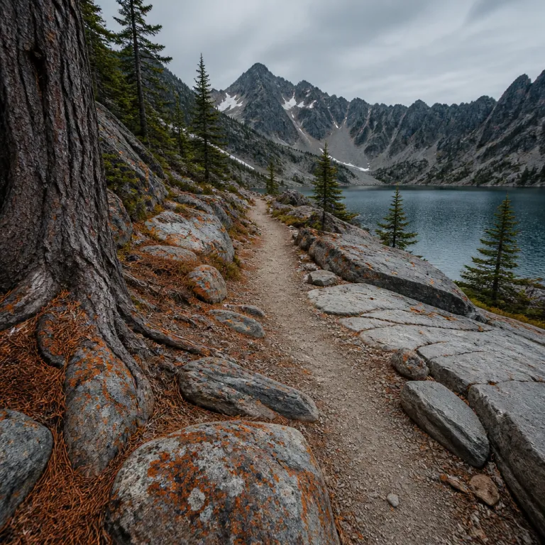
Why off the radar hikes in the PNW reward the patient traveler
Remote hikes in the PNW offer a rare blend of solitude and drama. These routes sit beyond the usual Washington day-trip radius, yet they remain accessible for a well-prepared hike with solid navigation skills. Many lie inside or just beyond a national park boundary, where strict protections keep the forest and mountain ecosystems remarkably intact and the air scented with fir, cedar, and wet stone after summer storms.
Across this vast Pacific Northwest region, elevation and distance shape every experience. A short hike of only a few miles can still feel demanding when the elevation gain reaches several hundred feet through dense forest or over exposed rock. For example, a 5-mile round trip with 1,200 feet of gain can feel tougher than a 9-mile route with 800 feet spread more gradually. Understanding the relationship between distance, elevation, and your own fitness is essential before you commit to any long round-trip itinerary.
Trail management here is serious work, not an afterthought. The Pacific Northwest Trail Association oversees the long-distance Pacific Northwest Trail, while the Pacific Crest Trail Association manages the Pacific Crest Trail that crosses Washington and the wider region. The U.S. Forest Service and the National Park Service coordinate trail maintenance, often with local hiking clubs, to keep each trail safe despite heavy winter snow and seasonal washouts that can reshape creek crossings and erode steep switchbacks.
Seasonality defines how you experience these quieter hikes Washington travelers love. Summer brings the most stable conditions, and many hikers agree that this season offers the most favorable weather. Shoulder seasons reward patient hikers with fiery larch forests and fewer people, but trip elevation profiles can change quickly when early snow covers a pass or a narrow ridge. In winter, some routes transform into snowshoe journeys, where a modest elevation gain feels far more serious in deep powder and short daylight.
Because these routes are less known, you cannot rely on a casual online rating alone. Many platforms compress complex realities into a single number, ignoring how total miles, exposure, and navigation challenges interact. Treat any rating as a starting point, then study topographic maps, recent trip reports, and official national park or forest advisories before you choose your next hike, paying close attention to notes about blowdowns, washed-out bridges, and lingering snowfields.
Hidden alpine circuits near mount Rainier beyond the classic viewpoints
The area around Mount Rainier holds some of the most compelling hikes in the PNW, yet many visitors never leave the famous roadside viewpoints. Step just a little farther from the main parking areas and you will find quieter trail networks that frame the volcano with sweeping mountain views. These routes often combine flower-filled meadows, old-growth forest, and high lakes in a single ambitious round trip, with wildflower perfume and the low rumble of distant waterfalls following you along the trail.
Within Mount Rainier National Park, look for lesser-known loops that start from secondary trailheads rather than the marquee lots. For instance, the Spray Park–Seattle Park circuit from Mowich Lake covers roughly 16 miles round trip with about 3,800 feet of elevation gain, while the Summerland–Panhandle Gap outing from the Fryingpan Creek trailhead runs close to 12 miles with around 3,000 feet of gain. Always verify the exact distance and elevation profile on an updated map, because snowfields and washouts can shift the practical route from one season to the next.
On the Rainier south side, some trails contour above the tree line for hours, offering uninterrupted mountain views of Mount Rainier and the surrounding peaks. The Skyline Trail loop from Paradise, for example, is about 5.5 miles with roughly 1,700 feet of elevation gain, and a longer extension toward Panorama Point can push the outing closer to 7 miles. These high traverses often cross a pass where the trip elevation briefly spikes, then descend toward a hidden lake basin that sees far fewer visitors than the famous roadside lakes.
North of the volcano, the forest deepens and the mood changes. Here, a hike–lake combination route might weave through dense conifers before breaking out at a turquoise lake framed by cliffs and distant glacier-capped mountain summits. The Tolmie Peak–Eunice Lake trail, for example, is about 7.5 miles round trip with roughly 1,100 feet of gain, and rewards hikers with a fire lookout panorama over Mount Rainier. Because these circuits sit farther from Seattle, the average rating on hiking platforms often reflects fewer reviews, so read each rating carefully and prioritize recent, detailed accounts.
Families or travelers combining these hikes Washington adventures with other off-the-beaten-path journeys might appreciate planning support. For example, an elegant hidden paths itinerary in Costa Rica can mirror the same balance of comfort and wildness you find near Mount Rainier. Whether you choose a short hike or a full-day round trip, always carry a map, GPS device, and enough layers for rapid weather shifts around this massive mountain, and confirm current conditions on the official Mount Rainier National Park website before you go.
Quiet forest and lake routes in the Snoqualmie region and along Snoqualmie Pass
East of Seattle, the Snoqualmie region offers some of the most accessible yet underrated hikes in the PNW. While a few famous viewpoints near Snoqualmie Pass draw crowds, many nearby trail options remain surprisingly calm even on summer weekends. These routes are ideal for travelers who want a half-day hike with real elevation gain but limited driving distance, plus the chance to end the day with dinner back in the city or a nearby mountain town.
Typical forest and lake itineraries here range from 8 to 16 miles round trip, with elevation gain between 600 and 1,000 feet depending on the chosen trail. The Pratt Lake trail, for example, runs about 11 miles round trip with roughly 2,300 feet of gain, while the quieter Margaret Lake route near Lake Kachess covers around 6 miles with about 1,500 feet of elevation gain. Because Washington driving times from the city are short, you can start early, complete a satisfying round trip, and still return for dinner without rushing.
Many Snoqualmie Pass routes follow old logging roads before narrowing into single-track trail, which makes navigation straightforward even for visitors new to the Pacific Northwest. Look for options where the distance and elevation profile spreads the climbing across several kilometers rather than stacking it into one brutal ascent. The Kendall Katwalk section of the Pacific Crest Trail, for instance, is roughly 12 miles round trip with about 2,600 feet of gain, and its steady grade suits travelers acclimating to elevation while still delivering mountain views over the pass and into the deeper Cascades.
For those who enjoy pairing hiking with other off-the-radar adventures, the mindset you bring to a quiet Washington forest trail also suits desert plateaus and canyon country. Planning an off the radar trail itinerary around Kanab can complement a Snoqualmie Pass trip, offering a striking contrast in landscape while keeping the same focus on solitude. In both regions, always check the latest rating and conditions, because storms, blowdowns, or late snow can transform an easy hike into a more serious undertaking and may affect parking access or trailhead roads.
Wildlife encounters add another layer of interest to these forest routes. Common sightings include deer, bears, and various bird species, especially at dawn and dusk near meadows and lakes. In late summer, huckleberry bushes along the trail can attract both hikers and wildlife, so respect distance, store food securely, and remember that you are a guest in their habitat, whether you are pausing beside an alpine lake or crossing a shaded pass on your way back to the trailhead.
Remote circuits on the Mountain Loop Highway and in the North Cascades
The Mountain Loop Highway northeast of Seattle acts as a gateway to some of the most atmospheric hikes in the PNW. Once you leave the pavement for gravel spurs, you enter a landscape of steep forested slopes, hanging lakes, and sharp mountain ridges. Many of these routes feel wilder than their Washington distance from the city would suggest, especially outside peak summer when morning fog clings to the valley and the sound of the river echoes through the trees.
Classic circuits along the Mountain Loop often combine river valleys, a steep climb to a pass, and a high lake basin in a single round trip. The Gothic Basin trail, for example, is about 9 miles round trip with roughly 2,800 feet of elevation gain, while the Lake Blanca route runs close to 7.5 miles with around 3,300 feet of gain. Expect distances between 10 and 20 miles round trip on more extended linkups, with elevation gain that can exceed 1,200 feet on ambitious itineraries.
Farther north, the North Cascades region raises the stakes again. Trails in and around North Cascades National Park deliver some of the most dramatic mountain views in the Pacific Northwest, with jagged peaks, hanging glaciers, and deep blue lakes. The Cascade Pass and Sahale Arm combination, for instance, is roughly 12 miles round trip with about 4,000 feet of gain, and many hikes Washington travelers attempt here involve sustained elevation gain over thousands of feet, so honest self-assessment matters more than chasing a high rating on a popular app.
Remote hike–lake combinations in the North Cascades often require careful planning. The Blue Lake trail off the North Cascades Highway is a shorter option at about 4.5 miles round trip with roughly 1,000 feet of gain, but rugged terrain, creek crossings, and lingering snowfields on nearby routes can slow your pace dramatically. Always consult the National Park Service or U.S. Forest Service for current conditions, and remember that some trailheads require permits or limited entry systems during the busiest part of the season, along with parking passes at certain national forest sites.
Because these areas remain relatively undeveloped, they are ideal for travelers seeking off-the-beaten-path experiences that still align with conservation goals. Increased tourism, when managed thoughtfully, can support local economies while funding trail maintenance and habitat protection. If you are curious about how wild landscapes support rare species, consider reading about exceptional wildlife destinations that share similar conservation challenges with the North Cascades and other protected Pacific Northwest ranges.
Coastal and rainforest escapes in Olympic National Park and beyond
On the Olympic Peninsula, hikes in the PNW take on a different character entirely. Here, the combination of rugged coast, temperate rainforest, and glaciated mountain interior creates a compact yet varied playground. Olympic National Park protects this mosaic, offering everything from short coastal walks to demanding multi-day circuits that link forest valleys and high passes, with the constant backdrop of surf, dripping moss, and distant snowfields.
Coastal routes in Olympic National Park areas often involve modest elevation gain but complex terrain. A simple-looking distance and elevation profile can hide slippery rocks, tidal crossings, and sections where you must time your hike around the tide tables. The Rialto Beach hike to Hole-in-the-Wall, for example, is about 4 miles round trip with minimal elevation gain, while the Shi Shi Beach and Point of the Arches route runs close to 8 miles with a few hundred feet of climbing. Many coastal hikes Washington visitors choose cover 8 to 14 miles round trip, with only a few hundred feet of gain, yet they still feel adventurous because of the dynamic shoreline environment.
Deeper inside the park, rainforest valleys host some of the most atmospheric forest trails in park Washington territory. The Hoh River trail to Five Mile Island is roughly 10 miles round trip with about 300 feet of gain, while pushing farther toward Glacier Meadows turns the outing into a strenuous multi-day trip. These hikes typically follow rivers for several miles before climbing toward a pass or a hanging valley, where mountain views open above the canopy. Expect distances between 12 and 20 miles round trip, with trip elevation gains that can reach 900 to 1,500 feet depending on how far you push beyond the standard turnaround points.
High country routes above the tree line offer a different perspective on Olympic National Park landscapes. The Hurricane Hill trail near Hurricane Ridge, for instance, is about 3.4 miles round trip with roughly 700 feet of elevation gain, and from certain ridges you can see both the interior mountain ranges and the distant Pacific Northwest coastline, a rare combination on a single hike. Because these areas are more exposed, always factor wind, sun, and rapid weather shifts into your planning, not just the raw distance and elevation numbers.
Outside the formal national park boundary, state parks and national forest lands extend the network of coastal and low-elevation forest trails. These areas often have more flexible access rules while still delivering the quiet atmosphere many off-the-beaten-path travelers seek. Check each trail rating carefully, as conditions can vary widely between heavily maintained national park routes and more rustic paths in adjacent forest districts, and confirm whether a Discover Pass or other parking permit is required at the trailhead.
Planning, safety, and ethical travel for off the beaten path hikes in the PNW
Thoughtful planning transforms remote hikes in the PNW from vague ideas into safe, rewarding journeys. Start by matching your desired distance, elevation gain, and terrain to your current fitness and navigation skills. A realistic self-assessment matters more than chasing a high rating or a famous name like Mount Rainier or North Cascades on your trip list, especially when you are responsible for less experienced companions.
Use multiple information sources when evaluating any trail. Official National Park Service and U.S. Forest Service updates should anchor your research, especially for routes inside a national park or national forest. Supplement these with recent trip reports, guidebooks, and digital trail apps, which have grown more sophisticated as innovation in mapping tools and GPS devices accelerates across the Pacific Northwest and beyond.
Safety basics remain non-negotiable, even on moderate hikes Washington travelers might consider easy. Always check weather forecasts before hiking, carry sufficient water and snacks, and inform someone about your hiking plan, including your intended round-trip distance and expected return time. For routes with significant trip elevation or exposure, pack extra layers, a headlamp, and a paper map as backup to your GPS, and confirm whether you need a Northwest Forest Pass, America the Beautiful pass, or park-specific permit for parking.
For quick reference, build a simple safety checklist before each outing: navigation tools (map, compass, GPS), extra food and water, insulation layers and rain shell, first-aid kit, headlamp with spare batteries, sun and insect protection, emergency shelter, and a charged phone or satellite communicator. Adjust this list for season and distance, adding traction devices, bear spray, or trekking poles when conditions or elevation profiles suggest they will be useful.
Ethical travel choices help protect the very landscapes that make these hikes special. Stay on established trail corridors to reduce erosion, avoid cutting switchbacks, and respect seasonal closures that protect wildlife or fragile vegetation. When camping, follow Leave No Trace principles rigorously, especially around lakes and in high-elevation basins where recovery from damage can take many years and where alpine meadows are particularly vulnerable to trampling.
Finally, remember that your presence contributes to broader regional dynamics. Growing interest in outdoor activities has increased trail usage, but it has also strengthened conservation funding and local economies when visitors support nearby communities. By choosing less crowded routes, respecting regulations in places like Rainier National Park and Olympic National Park areas, and sharing accurate information about distance, elevation, and conditions, you help ensure that future travelers can enjoy the same quiet forest paths and expansive mountain views.
Key statistics about long distance trails and regional hiking
- The Pacific Northwest Trail spans approximately 1,200 miles across the Pacific Northwest, according to the Pacific Northwest Trail Association, linking diverse ecosystems from the Continental Divide to the Pacific Ocean.
- The Pacific Crest Trail extends about 2,650 miles from Mexico to Canada, as reported by the Pacific Crest Trail Association, crossing Washington and providing a backbone for many section hikes in the region.
- Trail maintenance typically intensifies in spring, when the U.S. Forest Service and partners clear winter damage, which directly improves safety and reduces unexpected distance and elevation challenges for early-season hikers.
- Peak hiking season in this region usually falls in summer, when snow-free passes and longer daylight hours allow for higher-mileage round-trip itineraries with substantial elevation gain.
- Rising eco-tourism and increased trail usage have accelerated the development of digital trail guides and mapping apps, giving hikers more precise data on total miles, feet of gain, and real-time conditions.
FAQ about off the beaten path hikes in the PNW
What is the best time of year for hikes in the PNW ?
Summer generally offers the most stable conditions for hikes in the PNW, with snow-free passes and predictable weather on higher-elevation routes. Shoulder seasons in spring and autumn can be rewarding for forest and lake hikes at lower elevation, but snow and storms may affect any pass or exposed ridge. Winter is suitable mainly for experienced hikers and snowshoers who understand avalanche risk and shorter daylight hours.
Do I need permits for remote trails in Washington and the wider region ?
Some national park areas, such as Mount Rainier National Park, Olympic National Park, and North Cascades National Park, require permits for overnight trips and certain high-demand day hikes. Popular national forest trailheads near Snoqualmie Pass or along the Mountain Loop Highway may require parking passes like the Northwest Forest Pass. Always check the specific regulations for each trail before you hike, because rules can change from season to season and some systems now use timed-entry or quota-based reservations.
How should I interpret trail ratings and difficulty descriptions ?
A numerical rating on a hiking platform provides only a rough summary of other hikers’ experiences. Look beyond the rating to examine distance, elevation gain, terrain type, and recent condition reports, especially for off-the-beaten-path routes. When in doubt, choose a shorter round trip with less trip elevation for your first visit to a new region, then build toward longer hikes as you gain familiarity and understand how your body responds to Pacific Northwest terrain.
What wildlife might I encounter on these hikes ?
Across the Pacific Northwest, hikers commonly encounter deer, black bears, marmots, and a wide range of bird species in forest, lake, and mountain environments. In coastal and rainforest sections of Olympic National Park, you may also see elk and marine life along the shore. Maintain a respectful distance, store food securely, and follow all wildlife safety guidelines provided by the National Park Service or U.S. Forest Service, especially in areas with habituated animals.
How can I prepare physically for elevation gain on longer routes ?
To handle significant elevation gain and long miles round trip, build a base of regular walking or running on hills before your trip. Practice with shorter local hikes that mimic the distance and elevation profiles you expect in Washington, focusing on steady pacing rather than speed. When you arrive in the region, start with moderate hikes in the PNW, then gradually increase your round-trip distance and total feet of gain as your body adapts and you refine your gear and nutrition strategy.
References
- Pacific Northwest Trail Association
- Pacific Crest Trail Association
- U.S. Forest Service
