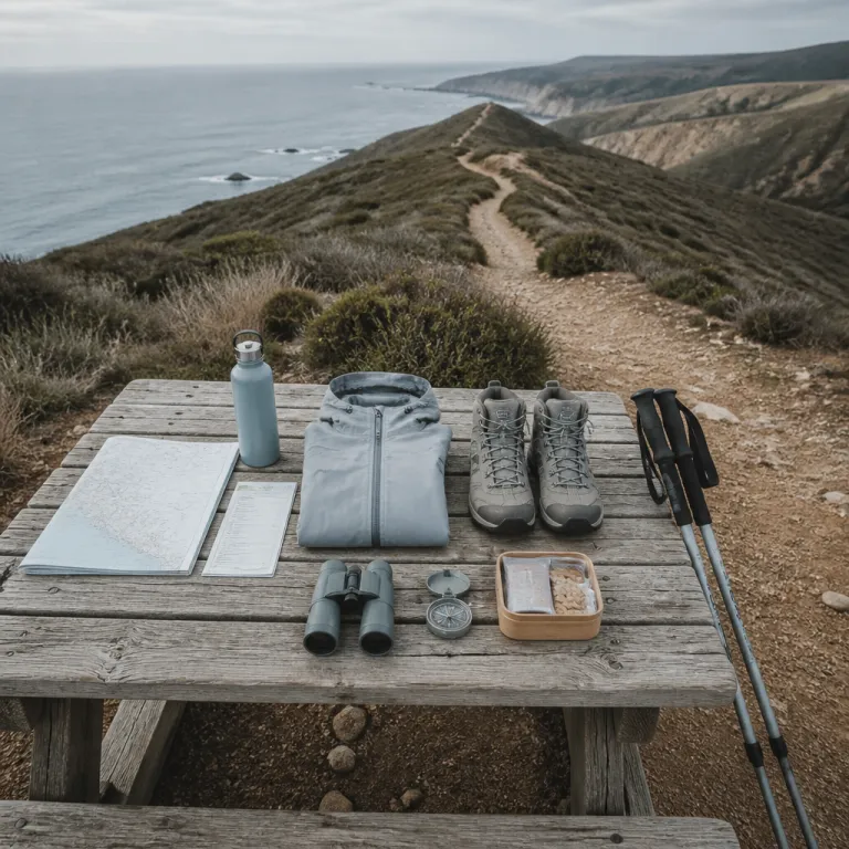
Why the best hikes in southern California reward those who wander further
Southern California invites you to hike far beyond its crowded overlooks. The best hikes in southern California for off-the-beaten-path travelers often sit just a few miles from busy freeways, yet they feel astonishingly remote. These hiking routes combine rugged mountain terrain, quiet canyon shade, and coastal views that rival many celebrated national parks.
Across this part of California, a single trail can climb from chaparral to pine forest in less than a mile, while the elevation gain quickly reminds you that every summit must be earned. When you choose lesser-known routes southern explorers favor, you trade queues at the parking lot for the sound of wind in the trees and the crunch of your boots on rock. That trade defines the real best hikes in southern California, especially for travelers who value solitude as much as scenery.
Planning an off-grid hiking trip here means understanding how winter storms, summer heat, and fragile ecosystems shape each outing. Many of the finest trails sit inside or beside a national forest or a national park, where regulations protect both wildlife and hikers. Before you set out, always check weather forecasts, carry at least half a litre of water per mile (more in hot weather) for the full round trip, and inform someone about your hiking plan, following guidance from agencies such as the National Park Service and the U.S. Forest Service.
High country secrets near Los Angeles: peaks above 3,000 metres
The mountains ringing Los Angeles hold some of the best hikes in southern California for strong legs and clear heads. Mount Baldy (officially Mount San Antonio), the highest peak in the county at 3,067 metres or 10,064 feet, offers a demanding ascent that feels worlds away from the city lights. On clear winter mornings, its summit can hold snow while the beaches of southern California remain warm and bright.
From the main parking lot at Manker Flats trailhead (approximate coordinates 34.236° N, 117.627° W), several paths climb toward the peak, and each route offers different views over the San Gabriel range. The classic loop via Baldy Bowl and Devil’s Backbone covers roughly 18 kilometres or 11 miles round trip, with serious elevation gain that rewards patient pacing and careful footwork. This is not just one of the best hikes in southern California by reputation; it is a true mountain experience that requires proper hiking boots, layers, and respect for changing conditions.
Ambitious hikers often pair Mount Baldy with other high summits such as Cucamonga Peak and Strawberry Peak, building a multi-day trip that links several remote ridges within the Angeles National Forest. These routes southern purists love rarely feel crowded outside holiday weekends, especially if you start before sunrise and carry any required parking pass or wilderness permit. For travelers who enjoy wild volcanic landscapes abroad, itineraries like these echo the dramatic ridgelines of remote Atlantic islands, similar in spirit to the quiet paths described in this guide to Santo Antão’s volcanic ridges.
San Gabriel canyons and the Bridge to Nowhere: adventure beneath the peaks
Not every memorable hike in southern California ends on a summit; some of the region’s most atmospheric trails follow deep canyon floors. The Bridge to Nowhere route in the San Gabriel Mountains is a prime example, threading along a rugged river corridor for about 16 kilometres or 10 miles round trip. Classified as moderate rather than easy, it is not ideal for beginners, yet it remains one of the best hikes in southern California for adventurous walkers who enjoy river crossings and historic structures.
The trail begins from the East Fork San Gabriel River parking lot near 34.236° N, 117.765° W and quickly commits you to a full-day hiking trip, with multiple river fords and stretches of loose rock. Over the miles, the elevation gain feels gentle compared with high mountain routes, but the constant boulder hopping demands balance and attention. Many hikers rate this among their favourite outings southern explorers can tackle in cooler winter months, when water levels are manageable and temperatures in the canyon stay comfortable.
If you are drawn to landscapes shaped by water and stone, this canyon hike pairs beautifully with other offbeat adventures such as subterranean routes in karst regions. For a deeper dive into that style of exploration, the article on exploring captivating caves shows how similar principles of preparation, navigation, and respect for fragile environments apply underground. Whether you walk beneath a concrete bridge or through a limestone chamber, the same careful planning turns a simple hike into a meaningful journey.
Coastal serenity from San Diego to Los Angeles: cliffs, pines, and sculpted rock
Along the Pacific edge of southern California, the best hikes in southern California for sea lovers unfold on sandstone cliffs and protected bluffs. Near San Diego, the Torrey Pines Beach Trail Loop offers around 3.7 kilometres or 2.3 miles of coastal walking, with views that sweep from rugged headlands to the distant outline of La Jolla. Dogs are not permitted on these footpaths, which helps preserve both the fragile Torrey pines and the sense of calm that defines this state natural reserve.
From the upper parking lot at Torrey Pines State Natural Reserve (roughly 32.921° N, 117.253° W), several short trails interlace to form a satisfying round trip, with only modest elevation gain but constant ocean views. These routes southern visitors often overlook are ideal in winter, when the light softens and migrating whales sometimes appear offshore. While the distance in miles round trip may seem modest compared with a major mountain peak, the combination of sea air, sculpted rock, and rare trees makes this one of the best coastal hikes in southern California.
Farther north toward Los Angeles, coastal routes near places like Torrey Pines’ counterparts and the famous Potato Chip Rock above San Diego blend ocean panoramas with playful geology. The Potato Chip Rock hike via the Mount Woodson Trail climbs several hundred metres over roughly 11 kilometres or 7 miles round trip, and its thin rock ledge has become an iconic photo stop. For a broader perspective on how such routes fit into global adventure culture, the piece on hiking expeditions beyond the ordinary explores why travelers increasingly seek these characterful trails instead of crowded viewpoints.
Desert giants and sky islands: Joshua Tree, San Jacinto, and San Gorgonio
Inland from the coast, the deserts and sky islands of southern California host some of the most varied hiking in the region. Within Joshua Tree National Park, trails weave between granite boulders and the twisted silhouettes of Joshua trees, offering short mile-long loops and longer routes that stretch for many miles. These hiking experiences feel especially magical in winter, when cooler temperatures and low-angled light transform the desert into a photographer’s dream.
Beyond the desert landscapes of Joshua Tree, the high country around San Jacinto and San Gorgonio offers classic summit objectives for experienced hikers. The ascent of San Jacinto from the upper Palm Springs Aerial Tramway station still involves significant elevation gain, even though the cable car removes many vertical feet from the approach. San Gorgonio, the highest mountain in southern California, demands a full-day round trip of more than 28 kilometres or 17 miles, and its summit views sweep across multiple national forest ranges.
These peaks require careful planning, from monitoring winter snow conditions to securing any necessary wilderness permits for national forest or national park zones. Trails can hold ice well into spring, and a simple hike can become hazardous without traction devices and warm layers. When you prepare thoroughly and respect the scale of these mountains, they become some of the best hikes in southern California for travelers who want a genuine high-altitude challenge.
Practical planning for off the beaten path hiking trips in southern California
Choosing the best hikes in southern California for your own abilities starts with honest assessment. A trail that feels like a gentle outing to a seasoned mountaineer can overwhelm a visitor unused to steep gradients and thin air at several thousand feet. Before committing to a long round trip, study the distance in miles, the total elevation gain, and the terrain type, then match those figures to your recent experience.
Logistics matter as much as scenery when you venture beyond the most popular national park viewpoints and city overlooks. Many remote trailheads near Los Angeles, San Diego, and Palm Springs have limited parking lot capacity, so early starts reduce stress and increase your chances of a quiet summit. Trail apps for navigation have become more common, yet they should complement, not replace, paper maps and a clear understanding of the route recommended by land managers.
Safety guidance from local park services remains consistent across the region and deserves to be taken literally. “Check weather conditions before hiking. Carry sufficient water. Inform someone about your hiking plan.” These simple steps, combined with appropriate footwear and layers for winter or summer, turn ambitious routes southern travelers dream about into rewarding, well-managed adventures.
Key statistics about southern California hiking
- Mount Baldy, the highest peak in Los Angeles County, reaches 10,064 feet or 3,067 metres, making it one of the most accessible high-altitude day hikes in southern California for fit walkers.
- The Bridge to Nowhere hike in the San Gabriel Mountains covers about 10 miles or 16 kilometres round trip, which places it in the moderate to long day hike category for most visitors.
- The Torrey Pines Beach Trail Loop near San Diego measures approximately 2.3 miles or 3.7 kilometres, offering a short yet scenic coastal route with minimal elevation gain compared with inland mountain trails.
- Across southern California, many classic summit routes such as San Gorgonio and Cucamonga Peak involve more than 1,200 metres of elevation gain, which requires strong cardiovascular fitness and careful pacing.
- Trail apps and GPS tools have seen increased use on hiking routes in the region, reflecting a broader trend toward digital navigation support for both solo hikers and group outings.
FAQ about the best hikes in southern California
What is the best time to hike Mount Baldy for clear views and safety?
The most reliable season to hike Mount Baldy runs from late spring to early autumn, when snow and ice usually retreat from the main trails. According to regional guidance, “What is the best time to hike Mount Baldy? May to October.” Outside that window, winter storms can leave hard-packed snow and ice on the summit slopes, which demands mountaineering skills and equipment.
Is the Bridge to Nowhere trail suitable for beginners?
The Bridge to Nowhere hike is generally rated as moderate, with about 10 miles or 16 kilometres round trip and multiple river crossings. Official advice states, “Is the Bridge to Nowhere trail suitable for beginners? Moderate difficulty; not ideal for beginners.” New hikers are usually better served by shorter canyon walks or coastal paths before attempting this remote San Gabriel route.
Are dogs allowed on the Torrey Pines hiking trails near San Diego?
Dogs are not permitted on the hiking trails within the Torrey Pines State Natural Reserve, which helps protect sensitive coastal vegetation and wildlife. The formal rule is clear: “Are dogs allowed on Torrey Pines trails? No, dogs are not permitted.” Travelers with pets can instead look for nearby beaches and multi-use paths outside the protected area.
How should I prepare for winter hikes in the mountains of southern California?
Winter hiking on peaks such as San Jacinto, San Gorgonio, and Mount Baldy requires warm layers, waterproof footwear, and traction devices for icy sections. Always check weather forecasts, avalanche advisories where relevant, and daylight hours before starting your trip. Carry extra food, a headlamp, and a paper map, because batteries drain faster in cold conditions and some high-elevation trails can be hard to follow under snow.
Which off the beaten path hikes near Los Angeles offer strong summit views without extreme distance?
Routes such as Strawberry Peak and Cucamonga Peak in the San Gabriel range provide substantial elevation gain and panoramic summit views within a manageable day hike distance for fit walkers. These trails are less crowded than Mount Baldy yet still rank among the best hikes in southern California for experienced hikers based in Los Angeles. Start early to secure parking and to enjoy quieter ridgelines before afternoon winds and haze arrive.
